Kristiansand

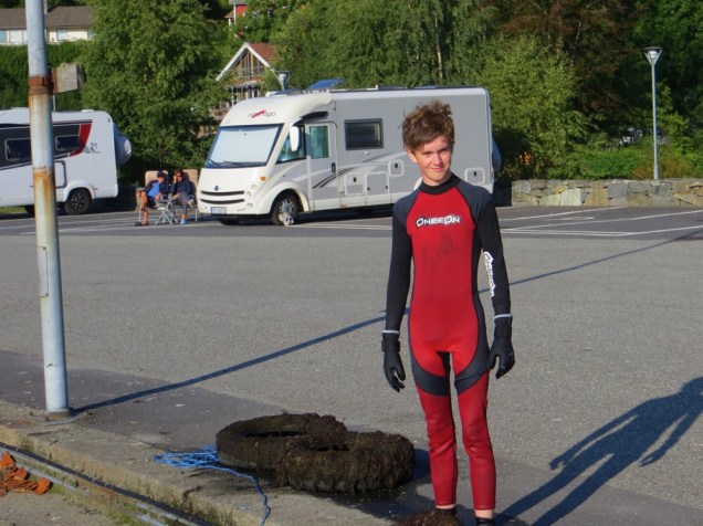
It’s been a slow couple of days, brought on by occasional showers, frequent downpours and torrential, heavens-opening, deafening, so this is what real rain looks like kind of sessions. Good days to catch up with some reading, some accreditation stuff, and start a series of taped shows. Today has been better, allowing us to walk around Kristiansand, only occasionally taking shelter under trees and, once, more expensively, in a coffee shop.

IMG_4631
Looking towards the cathedral

To end the day we are parked next to a greened area, lovely large park with lakes for swimming and a real network of walking trails. The area used to be a real dump (literally) before being cleaned up in the mid-1800’s by troops – cheap labour – and is now a great resource. Lots of people of all ages running, some obviously keen on beating a previous time, others more inclined to use a calendar for timing purposes, but all having fun.

This slideshow requires JavaScript.

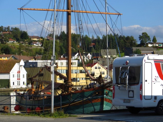
Kristiansand has been an interesting stop, particularly along the waterfront. We visited one of Norway’s largest cathedrals – for free (SO unusual). The building itself is quite simple by Gothic church standards, but has that usual Norwegian sauna feel. The air is warm, the church smells of wood, it’s dry (not so saunish I know), and generally relaxing. I was particularly interested to see a model ship hanging from the ceiling – a gift from Denmark’s hereditary prince in 1964 on the 100th anniversary of the battle. The ship, Jylland (Jutland) is currently berthed in Denmark and is the last remaining wooden screw driven warship.

IMG_4621

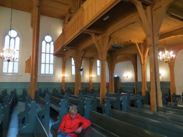
Also … Sorry we missed the organ recital this morning – we would have loved to hear this monster at work. How any one person can control all of this is simply amazing!

IMG_4622

We are going to try find a less direct road to Oslo, but so far this is proving a little difficult. It’s also interesting to see that ferries from here to Denmark will probably be cheaper than driving south from Oslo – thinking for another day.

Exit the Geopark, Enter History

IMG_4581
So happy not to be in a tent!

Clearly it’s not possible for our Norwegian weather app to be accurate all the time. It has been right on the button  – if rain is predicted at 4:00pm, it rains. Clear morning coming up? Don your shades. Except for today.

So, firstly a great big ‘Thanks’ to friends who donated a fantastic bottle of gin at the start of our trip. Don’t know the degree of sacrilege involved here, but it’s made a momentous hot toddy. Showered, clean, dry, very strong hot toddy in hand – who can remember belting rain and gusts that bent what little vegetation there was out of shape? A great morning’s cycle followed on from a good walk yesterday up to the Blåfjell (Blue Mountain) mines (closed) past Norway’s first protected geologic item (1923), the Rocking Stone (millimetres, but it does weigh 74 tons) …

The landscape has just continued to captivate us. The skyline is dominated by exposed domes, very little vegetation, and interspersed with a myriad of lakes fed by waterfalls coming in from every direction. The scale is immense, the sides sheer, and topping so many of the domes are erratics, there to remind you of the immense glaciation that has occurred.

IMG_4588

IMG_4591
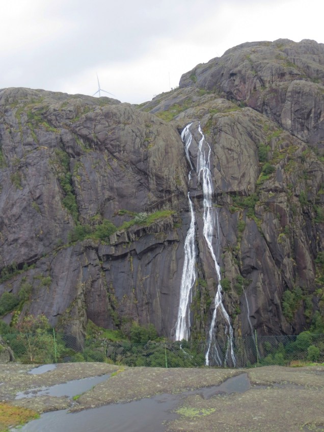
And to follow on from the Geography of it all, today we drove past Jøssingfjord, which had a cameo role in WWII. It was here that the German support vessel, the Altmark, was boarded by a British destroyer in 1940, freeing a large number of captured British sailors, but also violating Norway’s neutral status. Norway was invaded by Germany shortly afterwards. To bookend this, Jøssingfjiord was also the scene of a somewhat unsuccessful air attack by an international assortment of British, New Zealand, Australian and Polish pilots in 1945. A wreath is laid in annual remembrance of 4 Kiwis who died in the raid.

IMG_4589
Jøssingfjord

A final bit for the day was stopping at Helleren, which has the meaning of an overhang providing protection. The area has been inhabited for thousands of years, and for the past few hundred years, until recently, by crofters who kept sheep, a few cows, and supplemented this by fishing.

IMG_4594

I was told by a friend to do something useful today – I hope this is it!

We have now left the Magma Geopark, heading towards Kristiansand, Norway’s tropical beach paradise, or at least the most southerly part of the country. We travelled through the Geopark on a bit of a whim, urged by having a few extra days on hand. What a fantastic decision – everything has been just jaw-dropping beautiful, and I cannot overstate how many times each day we just stopped, and stared, and made weird noises – adjectives were not going to do! In part, I’m sure, this is made possible by having the time to just take the time … Contented campers indeed.

IMG_4566
My retirement home – lean out the kitchen window and catch salmon for dinner.

Magma Geopark, Egersund

We’ve been taking our time to travel down along the coastal route 44 after Pulpit Rock, rather than the shorter and quicker E39. We are very happy to have done so as it is a completely different landscape, and well worth the time. The road has been unexpectedly good – wide, little traffic, excellent viewing points, which has made traveling in torrential rain a little easier. We are currently enjoying a free carpark right next to the sea, and in the coastal centre of the Norwegian Magma Geopark. Along the way we’ve passed through Norway’s agricultural heartland, before the Anorthosite intrusions noted below.

IMG_4536
Hmmm, not the agricultural heartland…

The area is characterized by Anorthosite outcrops, which give the area its very distinctive topography. Forming the base of a Himalaya like range and formed as a huge magma chamber some 930 million years ago and 20km below the earth’s surface (tough luck to any ‘young earth’ nuts). This has now been exposed, and recently glaciated, so the landscape has all the characteristics one would expect. The rock itself is exceptionally poor in minerals, and therefore is only minimally vegetated – and that leaves fantastic views of a myriad of lakes (hello Minnesota) and countless high outcrops. We’ve had a great day cycling through the area around Egersund, making great use of a break in the rain – and well-timed too as it pelted down again after our return.

IMG_4558
Erratics left when the glaciers retreated
IMG_4548
Pixie-like person with mushrooms

Our parking spot is also unique. This precise area is the contact zone between the tidal waves from the English Channel and from north of Scotland, resulting in no tidal range – an ‘amphidromic point’. Live and learn. And apart from all the science, it’s just a really pretty place to be.

IMG_4562
Potholes left after rivers continued where glaciers left off

With a bit of luck with the weather we’ll follow up with a different cycle route heading out from Hauge and Sokndal – looking forward to this!!

Preikestolen / Pulpit Rock

Sometimes you get lucky …

IMG_4441
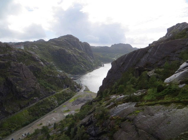
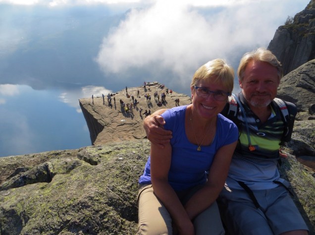
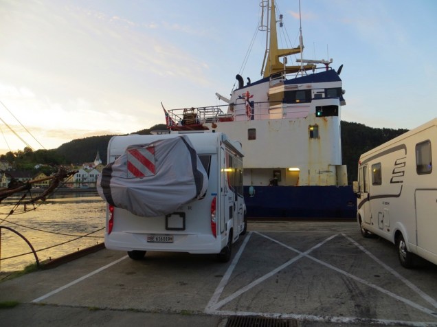
We woke up in the middle of the night, 6:00am, pitch dark, Niki making grumbling sounds while I put on tea – it’s a full-service campervan this one. We had a good night’s rest at the marina in Jørpeland, which cost us 150NOK, but well worth it, and with substantial savings to be had – read on.

A light breakfast, we got the bikes ready and set off towards Preikestolen, our outing for the day. Only 9km away, with a small climb of around 400m, but far better value than the 250NOK for parking, or an equally outrageous price for the 10 minute bus ride.

On the way up, still cool, with very dense fog, we were passed by a number of people coming down who had made even earlier starts in order to see the sunrise. General disappointment with this, as by now the visibility was down to no more than 20 meters. A 2 hour walk took us the Preikestolen, but so wreathed in mist that we might as well have been 3 feet off the ground. Not to be rushed, we enjoyed our time watching other tourists taking advantage of the absence of vertigo, and sitting with their legs over what we knew to be a 604 meters above sea level – and that’s the fjord directly below us (oh, that’s 1981 feet for those non-metricated Luddites).

This slideshow requires JavaScript.

And then the clouds broke up. And then the mist lifted – I need adjectival help on the views along the Lysefjord, over the Preikestolen itself, the mixture of cloud and reflection in the waters below – all while rediscovering my own sense of vertigo!

IMG_4511
The scale is immense
IMG_4497
Lysefjord, 2000ft down

The walk back was a little more crowded, given that busloads of school tours and others had been arriving – a bit of a China Yellow Mountain memory, for those who have experienced the mayhem of a million (yes, literally!) people on a single mountain.

My heart went out particularly to our German neighbours. The Germans may well have invented the current iteration of the walking stick – carbon, adjustable, soft grips, multi-colours, rock/sand/snow varieties etc etc. They use them with careless precision, a sort of Tetonic thoroughness in placement of tip, angle of incline, steady backward thrust, and all in silence. I can imagine their national pain when Spanish tourists come by, reaching down or up to their grips as no-one has explained that these are, indeed, the adjustable model. Click clack as the sticks are jabbed willy-nilly into cracks, onto rocks, spearing the occasional tree in passing. It’s like putting a choice lamb roast in the microwave – you can, but why would you?

IMG_4491

IMG_4474
Niki living on the edge

And then there’s this: A couple in full wedding regalia (albeit with her in hiking boots rather than high heels – sensible Norwegians!) beginning married life on a high … or is it on the edge? Time will no doubt tell.IMG_4521


Oh, and a big shout out to this kid and his friend – diving in Jørpeland harbour and pulling out dumped tyres – Good on you! I was so inspired I’ve picked up empty plastic bottles at each stop today.

IMG_4443
Good on you, mate.

And to end the day … a lovely carpark right on the Lysefjord. Look at those views to our left & right, and all for free. Great job, Norway, on providing outstanding dumping/water facilities – UK listening??

This slideshow requires JavaScript.


Odda to Sand

We have overnighted at the quay in Sand, a lovely little village on the Sandsfjorden, as we return to our intended destination of Stavanger. The town lost its car ferry service in 2016 and is definitely showing the effects, with empty shop windows through the main street. Chief claim to fame is the ‘Sandsfossen’ an enormously powerful waterfall/rapid which empties the Sand river into the fjord. We spent a couple of hours watching salmon head upstream while hopeful fishermen cast their lines in the calm area below the falls. The strength of anything to move upstream through this weight of water, the turbulence, is simply awesome. When a huge salmon leaps clear of the water and you see its body torpedo up through the white cascades – wow!

IMG_4413
Parking on the quay, Sand
IMG_4404
Sandvossen

We have done a 200km meander, a consequence of a bit of indecision on our part. We have a bit of time on our hands, so after leaving Bergen we decided to stick to the coastal road as we head south. I know it’s all coastal, but I mean the road running most coastal, over the islands rather than around the fjords. That took us over a completely different landscape, where glaciers have ground the hills flat, and the bedrock shows the earth’s skeleton. Stunning. So we overnighted at a lovely spot, level and protected from the wind, just off the beach at Rommetveit, then headed inland to Odda.

IMG_4354
Ølen – heart of Norway’s gas & oil sector

Along the way we stopped at Langfossen – I’m sorry that any photo we took simply couldn’t do justice. The falls are huge, 612m, and we could only manage to capture sections of it, given the road crosses the lower section. We continued up to Odda, one-time carbide capital of the world, and overnighted at the Trolltunga Hotel. Following the pattern we set in the UK, we had a beer, made use of the internet, and had a great night looking over the lake to our left, waterfalls right next to us, and the Hardangerfiord to our right. Norway just pops up these amazing overnight opportunities almost on a daily basis.

IMG_4362
Langfossen – but only the lower bits!

The drive down from Odda to Sand has been breath-taking. The road itself is generally good, albeit single lane width in many areas, but very light in traffic. Tunnel after tunnel, snow poles lining some sections – the poles are 3m high, and indicate just how much snow Norway’s premier ski region gets, steep climbs & descents – particularly in the tunnels (including a complete 360° drop) … We exited onto the road branching off towards Sand and things got even better! Lakes, cliffs, waterfalls … it just didn’t stop! Add to this that we were only doing 50km/h at best, and you end up with 2 hours of the most stunning scenery.

IMG_4389
Road from Odda to Sand

Our overnight, on the quay at Sand, has bettered expectation. There is a small beach not 50 meters away, our spot looks out over the harbour, we have an authentic old time sailboat as a neighbour, the sun is shining and there’s not a breathe of wind. We did wake up to a new neighbour this morning, though, and she certainly was noisy. Niki not happy at being up before sunrise.

IMG_4423
Niki’s beach
IMG_4415
Water’s so cold swans use one foot only!

Oh yes, we are back to sunsets and sunrises! I’m writing this as the morning sun streams into our lounge – and it actually rose far from where it set! We again have an East and West. We have seen the moon twice in Norway in over 2 months – who would have thought that my star app would be so absolutely useless?

IMG_4432
Noisy dawn neighbour